 new department at OSU. There were a total of 15 of us with our fantastic trip leader Professor Aaron Wolf. The class was intended to introduce the new students to their new home in Oregon. Having lived here for 2 years now I figured that I had seen all the amazing places in Oregon but I was happily proven very wrong.
 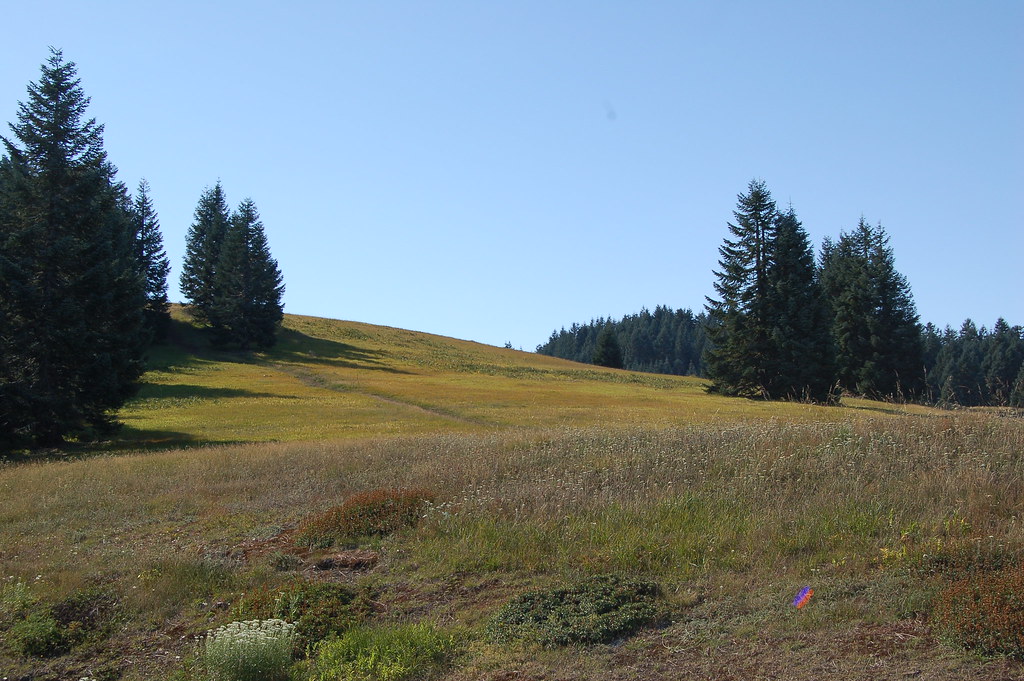 town of Waldport at the mouth of the Alsea River. It's a very cool little town and we got to walk around the tourist center which had displays of the local wildlife and history of the area.
 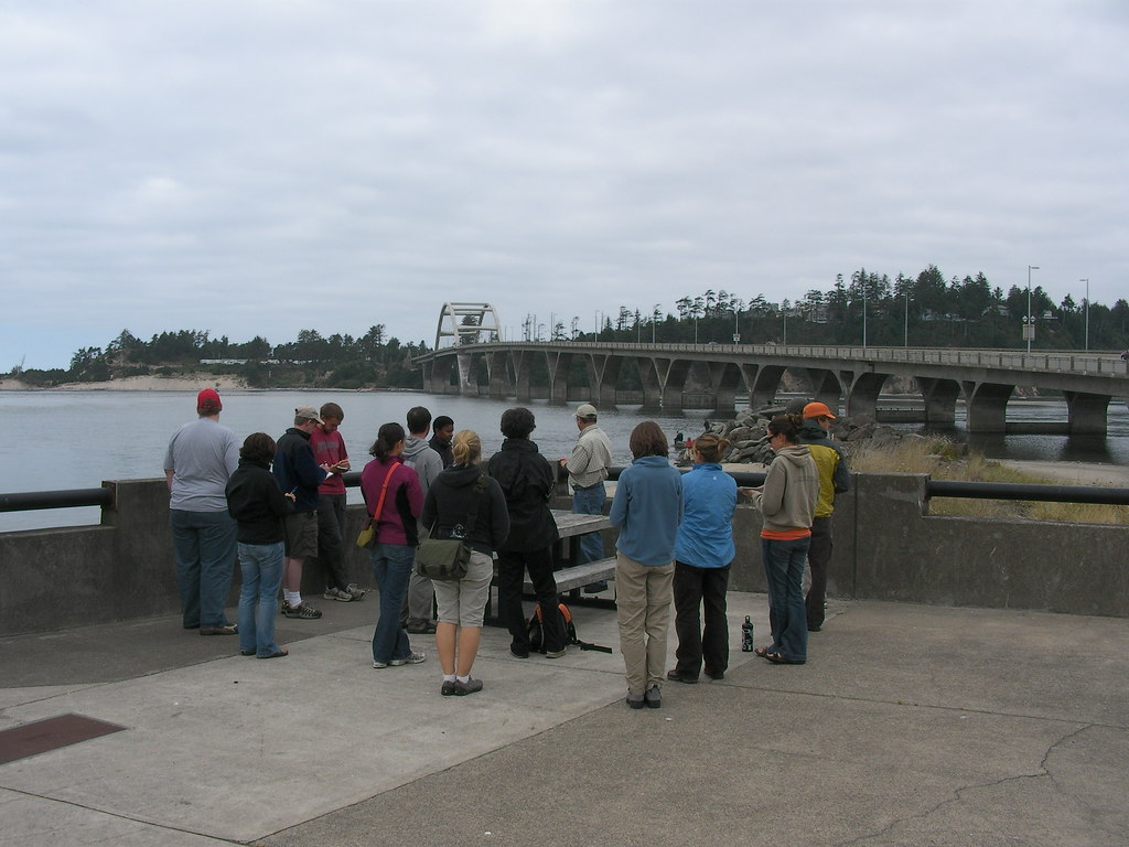 We learned that in the past settlements began east to west along the major rivers leading to the ocean in oregon but in recent times the central corridors of major highways such as 101 and I5 have led to development in north - south trends now which poses a big challenge for water resource management for those towns between rivers on the rocky coast. We grabbed some lunch there while checking out the historic bridge over Alsea Bay before heading out.
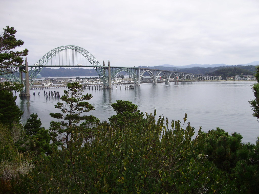 the entire coastline of beaches in Oregon is considered public property (anyone can go to any beach anywhere and nobody living on the coast can block access to a beach) but I didn't know that it was managed entirely by Oregon Parks and Recreation. I also learned that beaches are disappearing in Oregon at a rate of about 1 vertical mm per year due to rising sea level but that stretched out horizontally is 50x so 1mm in rising sea height = 50mm of beach now underwater! He found this data by highly accurate measurements in the bay at Newport.
 I had been here before and hiked the area but it was nice to stop and have it explained to me. I learned that the very large spit of sand that forms Netards Bay is formed by sand and sediment deposited by the Columbia River far to the North that is brought down to this area by beach and ocean currents. This area is always beautiful and I was glad to share some good hiking trail ideas with the group. We also learned that the Dee River is the shortest river in the U.S. and that the smallest harbor is Depoe Bay which we also passed.
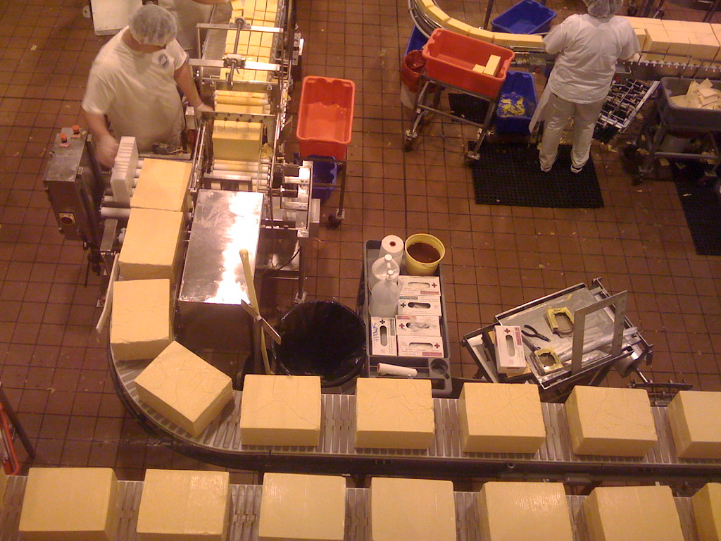 It was really neat to see how much cheese was flying out of this factory and it reminded me of the tour Emily and I took of the
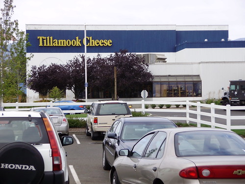 Ben & Jerry's ice cream factory in Vermont. At the end of the self-guided tour we were able to sample a variety of cheeses and I fell in love with the salty cheddar cheese curds there because they tasted great and had a really cool squeek against my teeth as I chewed them up. I of course also had to sample the great ice cream flavors so I got a big 5-scoop dish of licorice, peach cobbler, marionberry, strawberry, and blueberry. I then also ate the rest of Andrea's dish as well... mmmm I love ice cream. Our destination for the night was a National Guard base called Camp Rilea where we all got to share cabins and beds after a great dinner. A party of guests to the camp beside us donated a massive pot of spaghetti to us as well as half a watermelon. We all were split into food groups and of course mine was the herbivores. There was also a veggie group and a group of non-garlic eaters which I called the vampires.
 General who is a professor at OSU who helped found the camp way back in the 50's and because of him our field trip always has a place to crash there in beds for the first night of the
  trip. General Chuck Rosenfield? was one of the first people in the military to really think GREEN about how to build the camp and his influence on the camp has been great. Today, Major Martin at the camp has developed an unbelievable way to manage the wastewater of the camp that I'd like to describe here:
 them to make e85 gas, and enough of it to fuel the entire fleet of vehicles there making the camp self sufficient for fuel/energy. The camp also employs wind turbines to power the electricity there and has won the 2006 Army Environmental Quality award.
 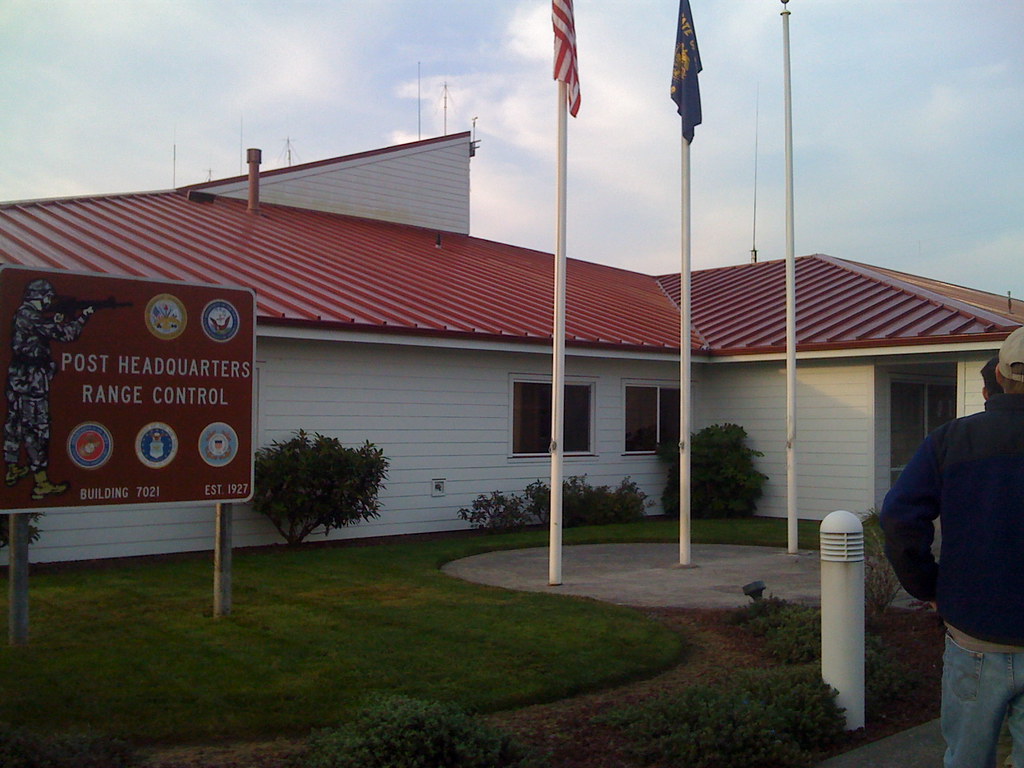 for police, SWAT, and other military training. We had a tour around the facility by Cpt Ji and Ltd Tim Odahl who explained to us that the facility was for the community more than just military requirements. I was thoroughly impressed by everything and everyone we met and it was nice to know that the National Guard really does think environmentally about it's practices. Back in the day I would have even considered joining the Guard if it wasn't for the fact that I could be sent away to fight in wars I don't believe we should be in. When I asked what cpt. Ji's opinion was about the war and how he managed it he gave me the best answer I've heard yet, "When you're forced to
  go over there you don't think of it as fighting the enemy,
 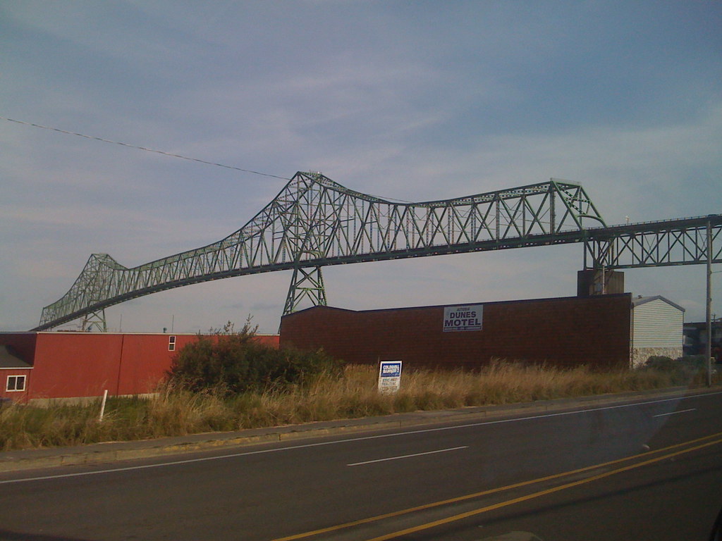 you think of it as fighting for each other, fighting to keep your friends alive". I have all the respect for those guys and after seeing the facility and meeting those that manage it I came away from the Camp having a new respect for the National Guard and all they do for this country.
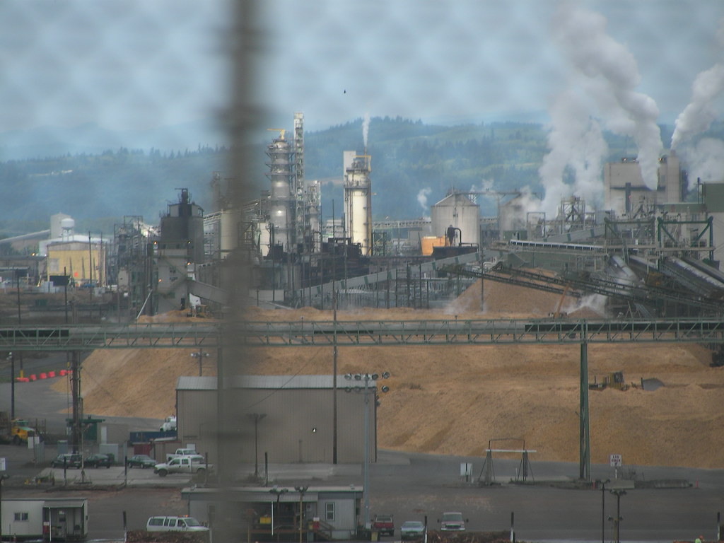 always blows my mind. We also got to drive through the town of Vernonia that was devastated last fall by the epic storms and flooding we got and was also depicted on the Discovery Channel show "Ax Men".
  After driving up the Columbia and briefly crossing into Washington we ended up passing Portland and arriving at the Columbia River Observatory on the Columbia River Historic Highway high above the Columbia River. Here we all had lunch and were told about the Missoula Floods that shaped the Gorge and created the very fertile wine valley of the Willamette
  Valley where Corvallis resides. We also learned later at one of our student presentations on the human geography of the land about the Bridge of the Gods which I'll is described here:
According to the legend cemented in Balch's book, the collapse of the Bridge of the Gods happened because of a violent conflict between two mountain spirits,  Wyeast (Mt. Hood) and Pahto (Mt. Adams). Both were vastly jealous over each other’s love for the Beautiful Loowit (Mt. St Helens). They threw red-hot boulders at each other, causing the earth to shake. Their disruption angered Tyee Sahale (The Great Spirit) who then shattered the Tomanowos (Bridge of the Gods). The broken fragments created what is today known as the Cascade Rapids, which are permanently submerged behind the Bonneville Dam.
Geologic Record of the Event
According 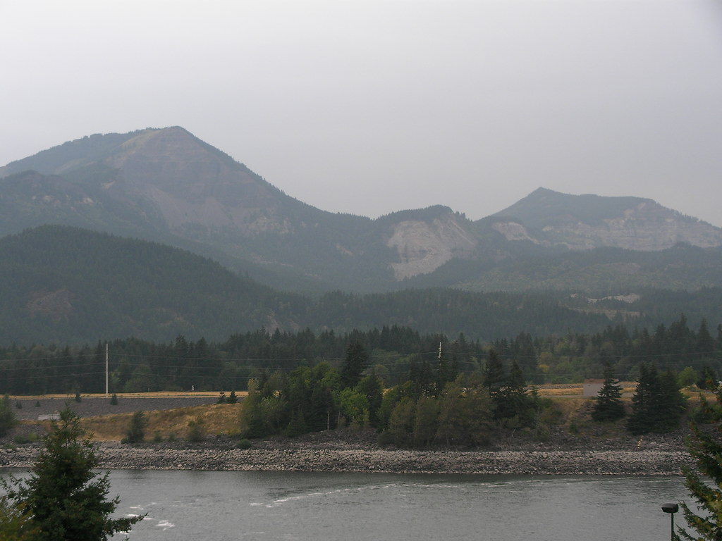 to scientific history, the bridge existed and was created by an enormous landslide between the lava cliffs of Table Mountain and the North wall of the Columbia Gorge, somewhere between 1100 and 1250 A.D. The bridge damned the river, standing about 200 to 300 feet above sea level, high enough so Native Americans could safely cross the river. The Bridge collapsed around the 1690s, which coincides with the date of the last Great Cascadia Subduction Zone earthquakes. The story of its collapse serves as a highlight of Balch's book.
It is pretty cool how ancient legends and stories are accurately backed up by 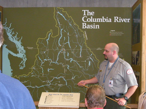 geological physical
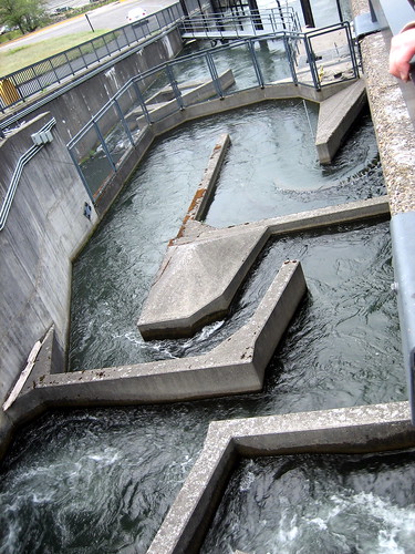 findings.
Next we toured the Bonneville Dam near Bradford Island on the Columbia. We were lucky enough to time it perfectly with a very rare tour of the inside of the Dam so we got to see the massive water turbines used to generate electricity as well as see the the fish ladder system installed at the Dam. The tour guide of course had wonderful things to say about the dam and all it 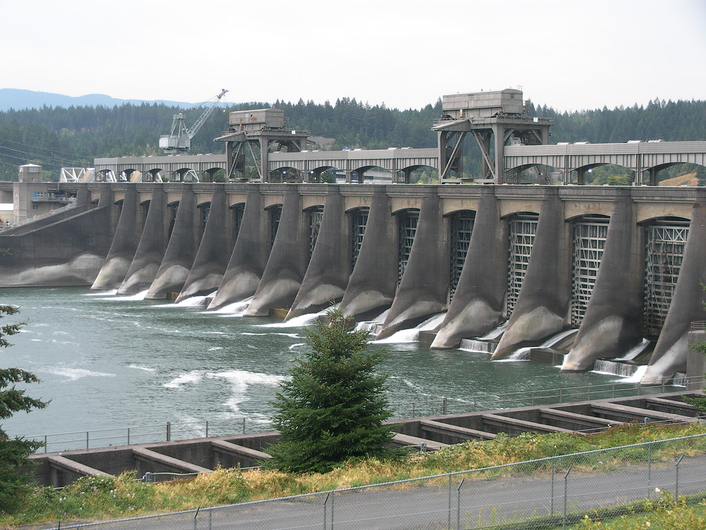 does to create efficient energy and all the other economic advantages as well as saying that it was very safe for fish to pass through. All that being said, coming from oceanography
 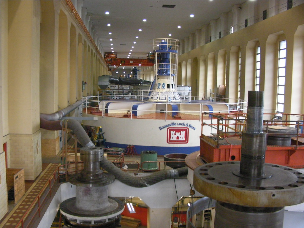 and learning about how damaging the dams on the Columbia are to wildlife, not to mention the fact that the dams displaced thousands of Native Americans from their fishing grounds resulting in annihilation of many groups... I'd have to disagree with him. But it was still cool to see the
 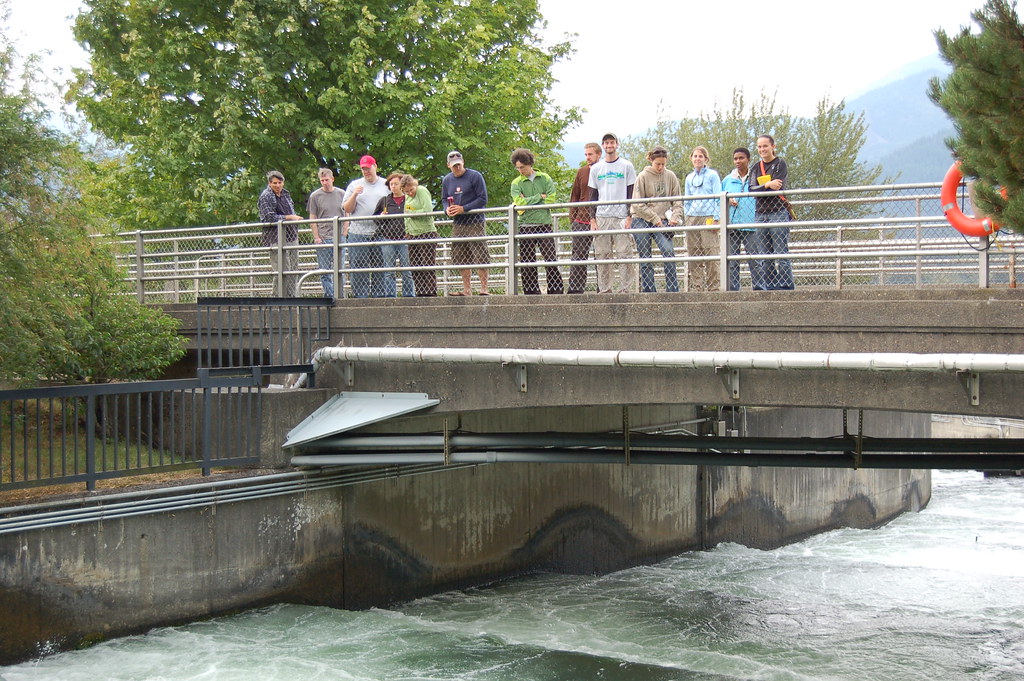 fish exhibits and watching them through glass panels swim through the concrete system while a person counted them for population
 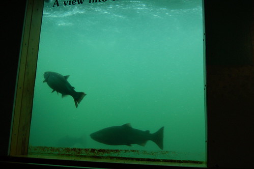 assessment studies. The fish channels today even have built in sensors that can detect fish that are "tagged" at nurseries to track their movement in the river which was pretty cool to learn about.
We ended up spending the night at a Tucker County  Park in Hood River because we couldn't stay up higher on Mt. Hood due to the massive Gnarl fire that was still raging. We had a big bonfire at the camp and were able to take showers there as well.
Saturday - Over Mt. Hood, through the Warm Springs Reservation to the Crooked River, to the top of Pilot Butte and then to drinks at the Deschutes Brewery
On 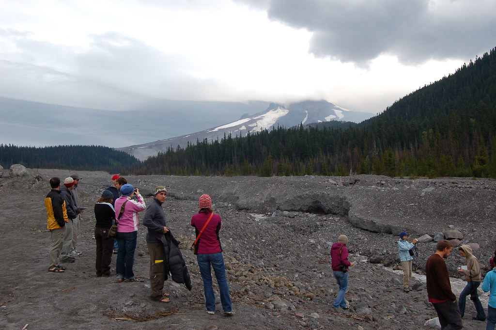 Saturday morning after packing up our site we drove up Highway 35 over the shoulder of Mt. Hood past Mt. Hood Meadows, stopping at the White River Debris Flow to check out the devastation that
  occurred here in the fall of 2006 when I first came to OSU. In that fall there had been massive snowstorms for a while then a very warm spell with a lot of rain and melting. This resulted in saturated ground at higher elevations on Mt. Hood eventually starting a massive debris flow that mowed down the mountain
  taking a 300 yard section of the highway clean out. Aaron told us that this has happened in the past but before the late 90's it had only happened once or twice... now it's happening every 2-3 years and is costing millions to repair each time. Even this time the bridge that has been build over the river is meant to break away in the event of another flow. This topic is
  very interesting to me and I believe researching these debris flows and their causes from weather patterns over the Pacific Northwest will be a focus of research within the Geography department with Anne Nolin. More
 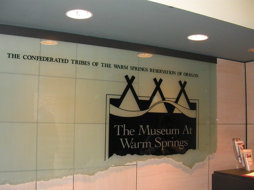 to come about that as my research progresses of course.
After Mt. Hood we headed down the east side of the volcano towards the Warm Springs Indian Reservation, stopping briefly to look at how the landscape changes from a temperate rainforest nature on the 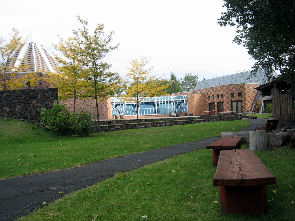 west side to a more high desert dry landscape on the east side with deep river valleys cut into the land. Once at the Warm Springs Indian Museum we were given a special tour by a local Native American named Rosemary Charlie. She took us all through museum and talked
 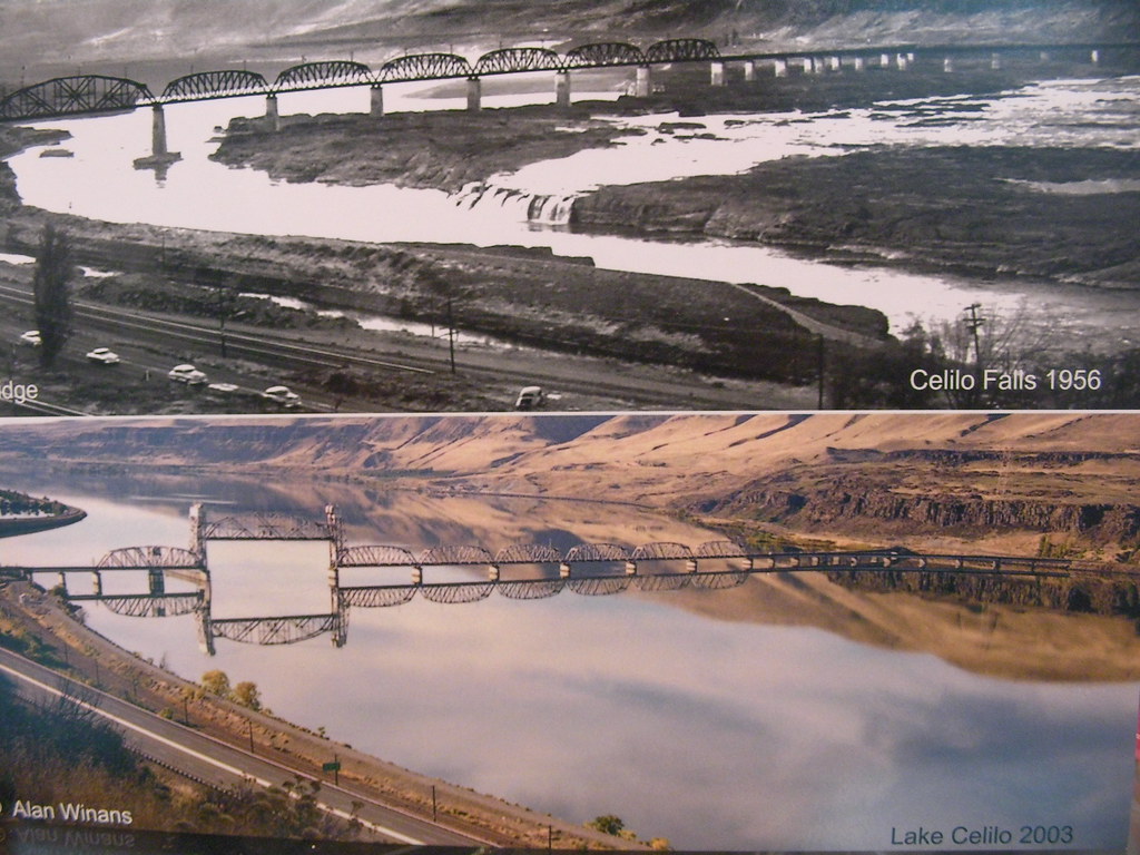 to us about her ancestors and the history of the land. A lot has changed in the Columbia River area since it was inhabited nearly 10,000 years ago, unfortunately most of the changes
  have not been beneficial to the Native Americans of the area. Walking through the museum and listening to how Rosemary lives her life made me feel like I had travelled back 200 years in time. After her tour of the museum we were able to eat lunch with her outside where she gave us a more personal account of how she and her family lives and the future plans of the Indian Reservation. Everyone in the group came away from the museum with deep feelings of sorrow for what her people had been been through over the years by
 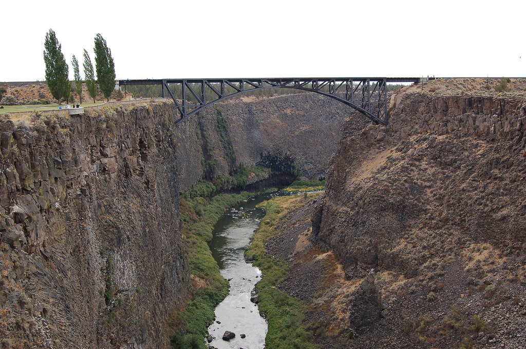 our ancestors.
On a more cheery 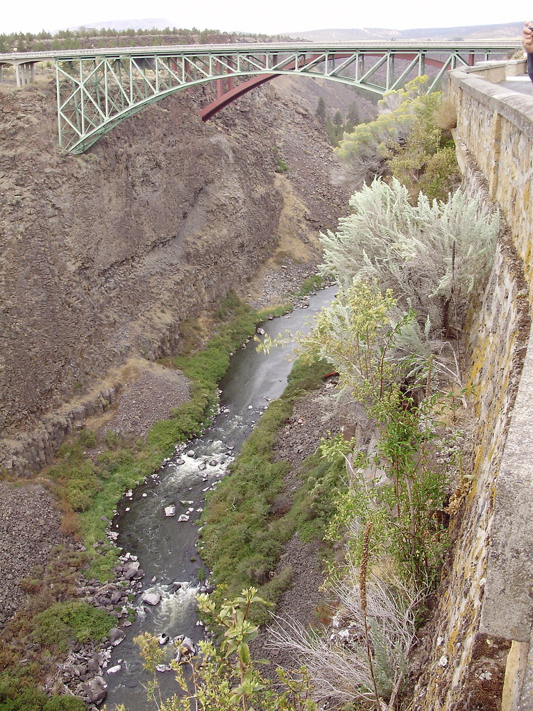 note, our next stop was outside of Redmond at the Crooked River which flows through Smith Rock and eventually into the Deschutes River which then empties into the Columbia to the North. The river runs through a 300ft deep canyon that we walked to the edge of to take some photos. There were signs everywhere telling people to not bring their dogs because they would
 fall in... I bet more people have jumped in than dogs have fallen in personally. There were buzzards all over the cliffs. We all took a walk to an old bridge over the river to get some better shots. We noticed a bunch of cars at the bottom of the canyon and Aaron informed us that people used to come to the edge and push their crap over the cliff for amusement and disposal.
We then drove past Redmond and into Bend to talk to a guy named Patrick who is in charge of water resource management for the town of Bend and the Deschutes  River. He gave a long but great presentation on the resources of the area and the difficulties of managing those resources.
  Most of it was a little out of my realm of understanding except the key concepts of getting multiple groups to work together towards a common goal... which is always difficult but it seemed he managed to accomplish well. After his presentation we took a drive to the top of Pilot Butte, an old volcanic conic shaped mountain with a road to the top and lookout area. It was
  getting near dark at the time so we only had a little while on the top. As we were about to head to the cars Aaron shocked all of us by suggesting that we go check out the Deschutes Brewery in town before heading back to the Tumalo Campground for the night. Aaron drove Andrea, Andi, and I to the Brewery because I had easy directions with my GPS. The rest went and bought food and met us there after we grabbed a table for everyone. We had a great time and we all split the bill. I even got to enjoy a big oyster shooter!
Sunday - Long Driving day from Bend to The Steens and then Hot Springs at the Harte Mountain Antelope Preserve.
This was certainly a long day of driving. We drove all afternoon across Eastern  Oregon stopping at a couple places to discuss the fact that we were entering the basin & range geological
 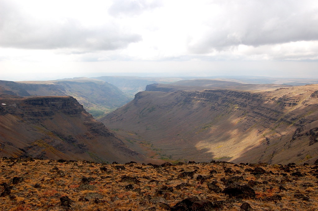 part of the state. This is where the land is stretched and blocks of land rise and fall relative to each other creating a land of flat ranges that drop down abruptly to basins that are lower then back up abruptly to ranges. So, as we were driving across the land we were constantly going up, then down, up, then down. We stopped at a public outhouse in Frenchglen for a bathroom break
  and then jumped onto
  a dirt road. I was riding in Aaron's SUV so the bumpy road wasn't as bad for me as it was for the vans behind us. We took off down the road and quickly lost the vans in our dust. We were making our way up Steens Mtn yet I couldn't see any peaks in the distance. We just kept going up and up past aspens (only place they are located in Oregon). We were passing by huge glacially carved gorgess in the land as well but still... no peaks. Finally when the vans caught up
 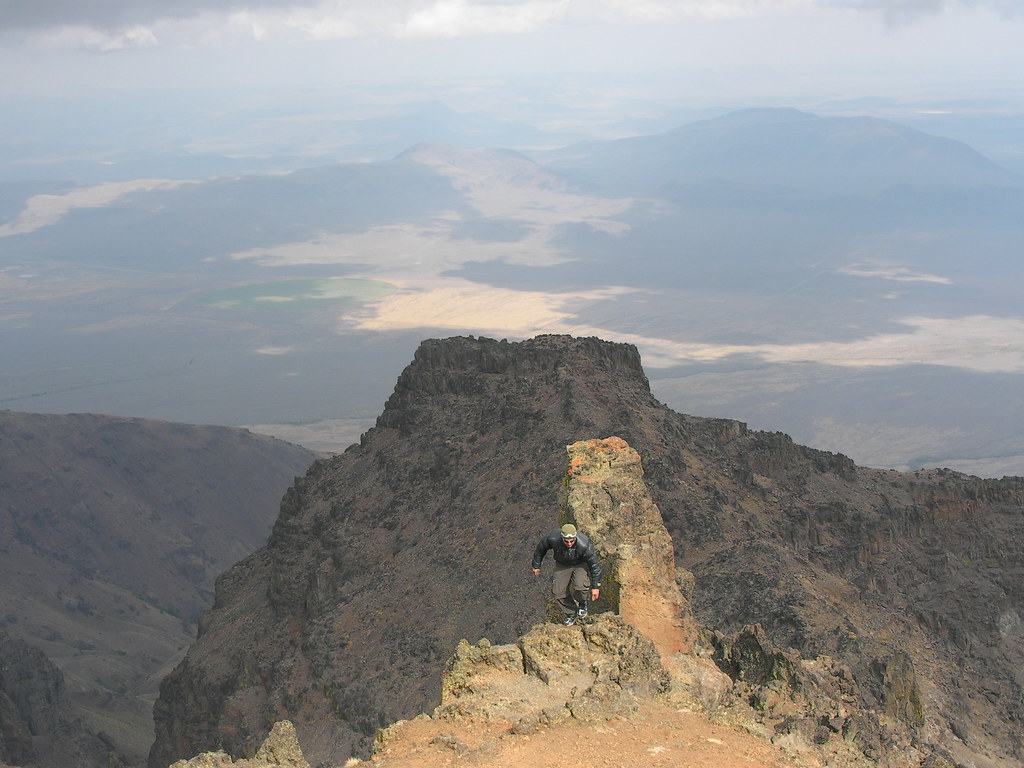 we all drove to the top
  of the pass and were blown away by the views. The east side of the Fault-Block mountain drops very steeply down to the Alvord Desert below. It's a massive example of the smaller basin and range that we drove through all day. The pass we were at was over 9,000 ft in elevation and yet it barely felt like we were driving up a mountain because it was such a gentle grade. The gorges we drove by were created by massive glaciers in the past formed by the very wet rain shadow on the western side of the mountain. It is unlike other fault-block mountains in Oregon because the steep face is on the East side, not the West. The desert below to the East looked like a massive dried up ocean. Very salty like a miniature version of the Great Salt Lake in Utah. It was an absolutely stunning area of the land and I can't wait to go back sometime and hike around the area.
After the Steens we made our way to Hot Springs Campground at Hart Mtn Antelope Preseve. Before we set up the camp we drove down the road to Petroglyph Lake to look at ancient pictographs etched into the rock hundreds of years ago. We mainly saw a lot of lizards 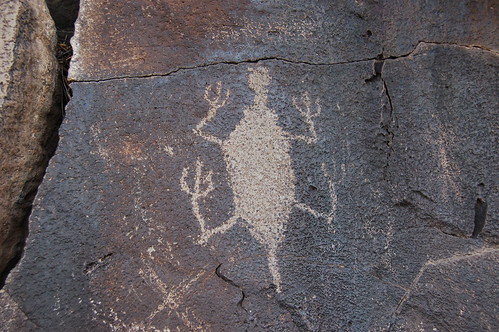 etched into the rock and a couple ones that looked like hunters. Personally I find it funny that people are so fascinated by these drawings. It's cool to see something that was drawn so long ago but trying to analyze what the drawings mean seems silly to me. I bet it was just the art flunky of the tribe that was sent to practice art on the rocks by the nearby bog or something. Or maybe they are simply ancient doodles. Most of them were lizards so maybe the individual just liked drawing lizards on everything and the only thing that lasted over the years were his drawings on the rocks.
After a great dinner we all set up camp then headed to the amazing hot spring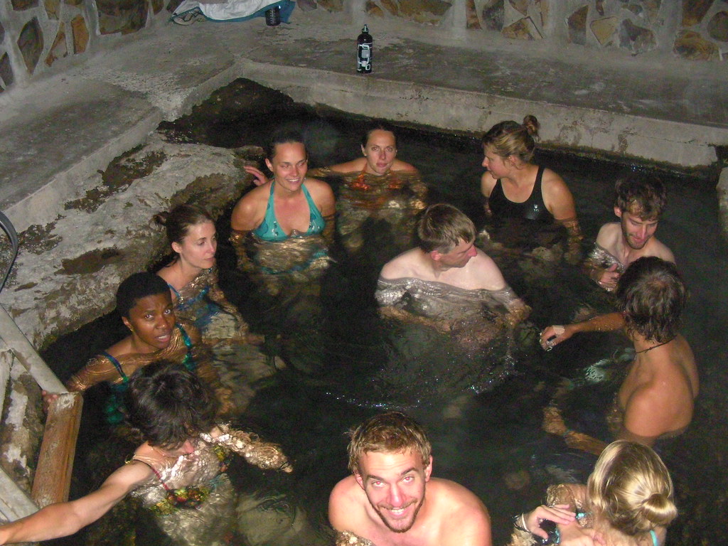 in the area that was built up into a big rock "hot tub". We all were amazed by how wonderful the water felt. I found a hole in the bottom that scared the hell out of me at first until tall Jeff came over to verify that it actually had a sandy bottom and didn't go all the way to China. We all stayed in the spring until our fingers were properly "pruned" before heading to bed in the very cold Eastern Oregon air. I was toasty warm the whole trip in my 0 degree bag and down jacket but others were cold at night so I offered up my jacket to them but nobody accepted.
Monday - Hotsprings to Newberry Campsite via Hart Mountain, Warner Valley, Winter Ridge, Summer Lake & the Paisley Forest Service, and Fort Rock
In the 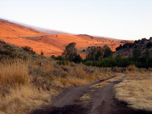 morning we drove over Hart Mountain for great views over Warner Valley
 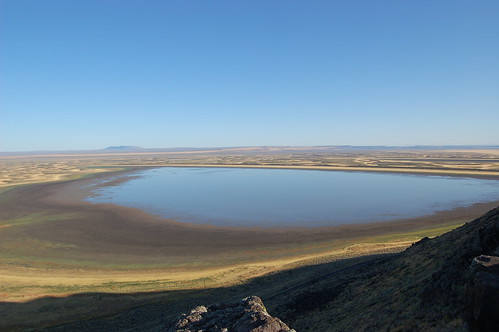 toward Winter Ridge and the Warner Mountains to the west. This area of Oregon is very cool because the lakes evaporate instead of drain into rivers. It is a landscape that I've never seen before. The land is shaped by rainstorms then the water simply evaporates forming beautiful channels in the land. These channels were beautiful yellows and oranges with the white
  coating of frost from the night before.
We then drove past Paisley up onto the shoulder of Winter Ridge overlooking Summer Lake below. We met the Paisley fire  crew up on the side of the mountain for a conversation about fighting fires and managing the forests in the area. They seemed like a good crew of people although the girl in the group with her Los Angeles Paris Hilton sunglasses and lollipop sucking habit seemed really out of
  place with the rest of the burly looking crew. Looking down into the valley the lake seemed completely dried up to me but in the distance someone pointed out the reflection of winter ridge on what was left of the lake water that hadn't evaporated yet. The fire
 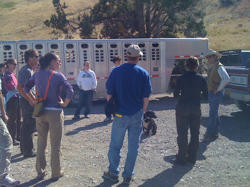 crew said that they had a very dry season this year. They talked about sustainably managing the forests in a way that would make both environmentalists and ranchers happy by allowing grazing on the public lands while also working to preserve the forest from destruction.
Down the road we stopped at a ranch the OSU co-operates with the state and other agencies. We spoke to the rancher in charge, Kent, about what life is like managing a  ranch sustainably on leased public forest lands. When urged to speak about his political preferences (by brave Tommy) he said that
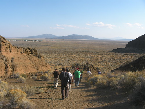 he and other ranchers usually voted Republican because Democrats usually don't favor public land grazing etc. Kent seemed like a really good guy and it was apparent from what he said that times are getting tougher and tougher for ranchers due to increased fuel prices and decreased cattle & meat market prices. I felt as bad for him as I did for the old dog that was dragging itself across the ground to each of us for attention.
On we went over Winter Ridge towards Fort Rock which seemed to be in the middle of nowhere. Later we would learn that Fort Rock is actually the caldera of an underwater volcano when the area used to be underwater... as in there was a sea there long ago. As the volcano  erupted (not part of the cascade range volcanoes)
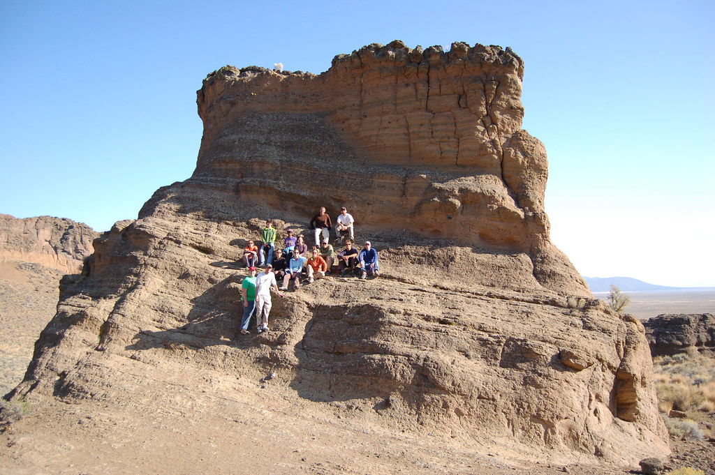 it formed a rim which was slowly, over thousands of years, eroded away by wave action leaving a horseshoe shape of cemented volcanic tuff (same rock that rock climbers love at Smith Rock). The walls of the caldera are still several hundred feet high and you can enter the area from the open end. Stories say that a band of settlers took shelter within the caldera
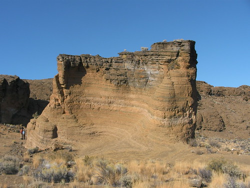 like a fort and were able to defend themselves against hostile parties. We parked the vans and took 45 minutes to walk around inside the caldera and check out the rock formations. The group decided to walk along the inside rim while I just struck a beeline course across the center scaring up the biggest hare (rabbit) I've ever seen. We got a great shot of the group up on a rock in the caldera.
We then continued on towards Newberry Crater where we would spend a very cold night under Paulina Peak. We had a great bon fire and I gave my presentation on the history of cattle ranchers in Harney County for Human Geography. While researching the area I felt bad to learn of how many people were tricked into buying "paradise" land in Eastern Oregon only to travel from the East coast and find barren lands too small or too unfertile to make a living on. But eventually cattle ranching took off and now it is one of the nations largest producers of beef cattle.
Tuesday - Sunrise on Paulina Peak through Sisters and Willamette Pass to H.J. Andrews Experimental Research Forest.
At 4:30am on  Tuesday morning about 6 of us got up to start our very early and cold walk up the road towards the top of Paulina Peak for the sunrise. We knew that the vans would eventually catch us
  walking up the road but we all felt a little stir crazy from riding in vans all week and wanted to do something a little more active. Ironically, I found myself to be the first person up, although I was usually the last for every other morning of the trip. Walking up the road under a clear sky of stars was really refreshing I must say. The vans
 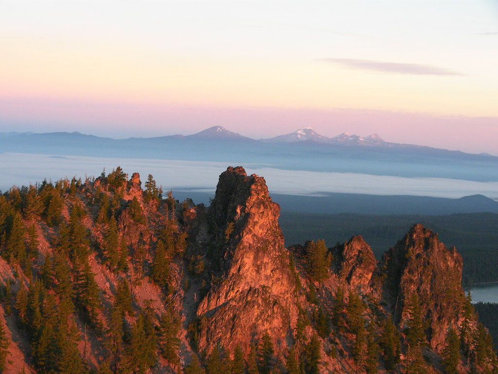 caught us about 2 miles into the 5 mile walk and brought us up to the summit. There we set up some tables to make coffee and hot chocolate while watching the oranges and reds beginning to glow to the East. Chevelle got an amazing photo of all our silhouettes against the glowing sky behind us. About half the group stayed in the van napping and waiting for the full sunrise while the rest of us walked around the summit of the peak to explore the informational signs and find the perfect spot to watch the sunrise. I hiked down to an overlook at the top of a cliff and found it to be absolutely perfect,
 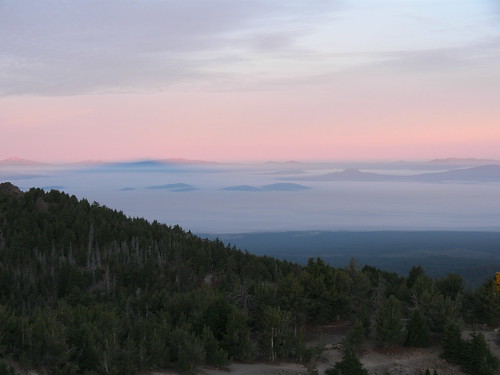 calling the rest of the group over to join me. There we watched one of the most beautiful sunrises I've ever seen. The
  glowing sun came up through several layers of clouds in the distance and illuminated the cliffs we were standing on in glowing reds. The Sisters and Jefferson in the
  distance were illuminated over the valley fog in beautiful colors and the shadow of Paulina Peak could be seen reaching all the way to
  Diamond Peak to the South. We could see from Mt. Hood all the way South to Mt. McLoughlin and Crater Lake. From the top we could also look down upon the amazing obsidian flow on Paulina Peak. We all
 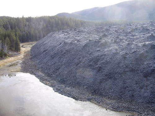 spent some time taking literally hundreds of photos from the overlook before moving to the actual true summit for Aaron to talk to us about
  the physical geography and for me to name every major peak in the distance for the group. :)
We then packed up our campsite below and headed to the High Desert Museum just outside of Bend. There we took our time going through all the exhibits and grabbing lunch after. Evan, 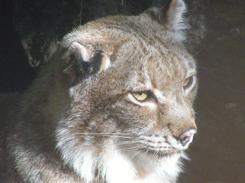 Andrea and I and a couple others checked out a live bird presentation where they brought out a screech owl. The cute little owl sat on a perch in front of us while she talked about it. It kept looking at her, then looking at us and shaking it's head around in circles. Very cute
 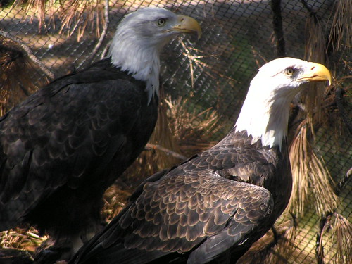 little feathered friend. The museum also had a few Bald Eagles, a Golden Eagle, and various other animals including a porcupine, a lynx, and various snakes, and turtles, all animals that you may find in the
 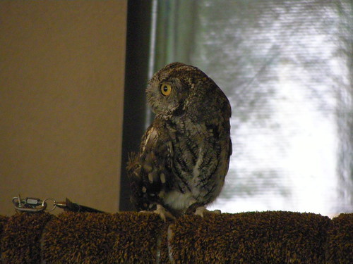 Eastern High Desert of Oregon. I was very impressed by both the size, and quality of the exhibits in the museum and was also happy that I didn't have to pay the $15 feet to enter on my own.
After the museum we headed to Sisters, OR where we picked up a ton of beer and wine to bring to H.J. Andrews later that evening. We then drove over Willamette  Pass to check out the Dee Wright Observatory there. It's always impressive to see the massive lava flows that came out of Little Belknap Crater there and everyone in the group new to Oregon
 were really impressed by the area as well.
From Willamette Pass it was a windy descent down rte 126 to the H.J. Andrews experimental research forest for drinks and dinner with the 2nd years who cooked us an amazing salmon dinner after they got back from their field research with Professor Julia Jones. They were very happy to see all the alcohol we  bought for them... hehe. After we washed the undercarriages of the vans of possible invasive species we set up our tents, played frisbee and hung out with the others until dinner. Shiloh was even there with the Forestry group (who somehow managed to snag our rooms from us). After a great dinner and a bunch of drinks all of the new students were able to sit down with the 2nd years and get their personal opinions about what is expected of us and what professors are like. It was a good discussion but I feel like there were several 2nd years students that kept contradicting each other. From there it was some ping pong drinking games and then bed.
Wednesday - Our Triumphant Return Home
In the morning we packed up our camp and said goodbye H.J. Andrews after a short walk through the woods of the experimental forest. We then drove through Eugene (accidentally missing I-5) to rte 99 back to Corvallis. We got back to campus around 1pm and took a group photo of us all, now much smellier and much hairier. Aaron went over on the giant wall map where we had been. It was truly a great trip and I now have many
  more close friends in a department that I am way more happier with and more comfortable in. I'm now super excited to start classes next week with my new friends. I just hope I can handle all the workload with my other two jobs and being TA for two classes....
Once I'm done labeling and commenting on the photos (I'm uploading about half of the 1,100 photos that were taken between all of us) I'll add them to this entry. Might take a while as I suddenly find my life very short on time... :)
No comments:
Post a Comment